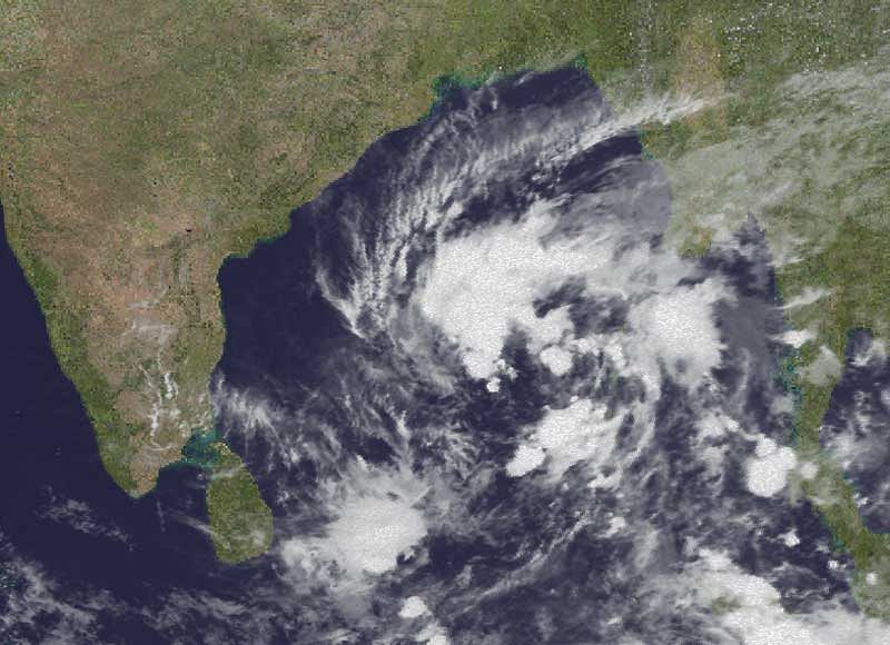
Tamil Nadu and Puducherry are expected to receive heavy rainfall this week as the deep depression over southeast Bay of Bengal has intensified into a cyclonic storm name ‘Gaja’ which is likely to make landfall between Cuddalore and Sriharikota on November 15.
The cyclonic storm lay 930 km east-northeast of Chennai and 980 km east-southeast of Sriharikota on Sunday morning and is very likely to intensify further into a severe cyclonic storm during next 24 hours, the IMD said. Cyclone Gaja is likely to increase gradually, becoming a gale, with wind speeds clocking 100 kmph, the IMD said.
As the IMD confirmed that the deep depression has intensified into cyclonic storm, the Tamil Nadu government said it was prepared to face the rains and asked district administrations to take necessary precautionary measures.
In the evening, Cuddalore, which is situated on the Puducherry border, the district administration held back-to-back meetings to check the preparedness of the official machinery and to ensure evacuation of people living in low-lying areas if necessary. Revenue Commissioner N Satyagopal told reporters in Tirunelveli that the government was prepared to face the monsoon and will ensure that nothing untoward takes place.
This is the first time Tamil Nadu is likely to witness landfall of cyclone in two years – in 2016 Cyclone Vardah hit the Chennai city in the second week of December leaving a trail of destruction along the coast. Just the previous year, the city witnessed unprecedented floods swamping the entire metropolis and its suburbs.
“Rainfall at most places with heavy falls at isolated places very likely to commence over north coastal Tamil Nadu and adjoining south coastal Andhra Pradesh from evening of November 14. Rainfall intensity is very likely to increase gradually thereafter with rainfall at most places and heavy to very heavy at a few places and extremely heavy falls at isolated places very likely over north Tamil Nadu,” the IMD said.
Weather blogger Pradeep John posted on Facebook that assuming Cuddalore as the landfall point, Chennai will see good rains from November 14 night or by November 15 morning and then after the cyclone moves into the Arabian Sea on November 16 or 17, Chennai can expect pull effect rains.
“Extreme rains can be expected around landfall area and also in north western Tamil Nadu. Tamil Nadu coastal belt of Chennai, Kancheepuram, Tiruvallur, Villupuram, Nagai will also get good rains,” John wrote on his Facebook page.