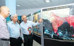

Speaking on the sidelines of a conference on Karnataka Geospatial Database here on Tuesday, he said the series of launches planned over the next ten years, including Resourcesat, Cartosat and other ocean and atmospheric observation satellites would push the number of earth observation satellites to 30.
The launch of Resourcesat-2 in January-February and Cartosat- 3 which will have a 30 cm resolution along with Mega-Tropiques will boost capacity on weather and earth observation.
The NRSC, which collects and disseminates all data is also in the process of providing real time services with the operationalisation of their ground station in Shadnagar near Hyderabad.
The centre has been set up with an investment of around Rs 40 crore and will be completely operational in June, 2011.
Jayaraman said the ground station would enable them to receive all data and supply all the users with the requested information directly, catering to as many as 1,000 users in a single day. At present, NRSC provides services to government bodies, educational and research institutes and private players with requested imagery information over a specified area. Information can range from a image of a piece of land for survey or a place to drill a borewell.
“As of now, it takes four to five days to deliver the data. With this new ground segment we would be able to do it within 12 hours and even supply emergency products (services) within one hour,” Jayaraman said.
Earlier, delivering the keynote address at the conference, he called for greater use of Global Information Systems (GIS) in India. Saying that only three million people were using it at present, Jayaraman called for making it more user-friendly and accessible to people.