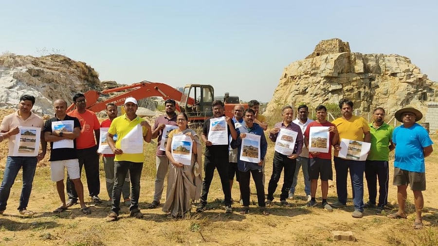
Residents staged a protest on Sunday as earthmovers began breaking open the rock formation adjacent to the 220-year-old Great Trigonometrical Survey (GTS) Tower near Jakkur, demanding immediate intervention from the BDA.
The Bangalore Development Authority (BDA) allotted 2.75 acres of land comprising rock formation, a lake and gomala land to an education trust for 30 years.
Residents urged the BDA to allot some other land and spare the area that has historical, geological, and scientific significance. So large is the rock formation that it covers survey numbers 37 and 87, which totals 20 acres.
In May last year, the BDA allotted 11,128 square metres of land (survey number 37) in Sampigehalli near Jakkur to Siddeshwara Education Trust for the purpose of “education”. It also issued a civic amenity site possession certificate to the trust. The resident group said the BDA did not follow the norms in the allotment.
As per the RTC (Record of Rights, Tenancy and Crops) records, the allotted property is gomala and part of it is a lake. There is also a rock formation, which is so large that it is spread over 20 acres.
Residents said they made several attempts to file a complaint with the BDA but were not able to reach the higher-ups. They want the Lokayukta to take a suo motu case as the allottee has started breaking down the rock formation.
Why GTS Tower is important
The site adjoins GTS Tower, one of the world’s most significant scientific endeavours ever.
In 1800, Lt Col Lambton used the tower as the centre point of the land survey that lasted 137 years. Bengaluru’s GTS points, which include Hennur-Bagalur and Mehkri Circle, played a critical role in the mapping of India.
