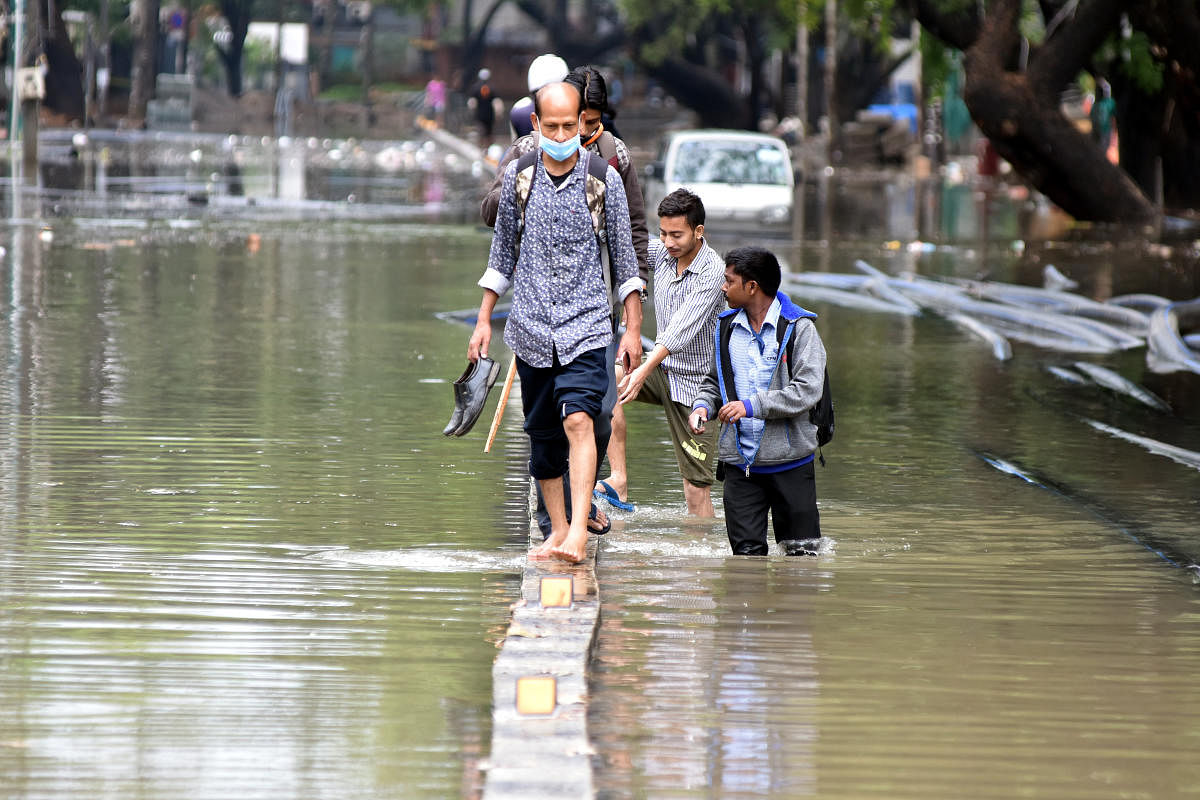
Several areas in Bengaluru were inundated after a downpour two weeks ago. The scenes were familiar: people wading through water inside their houses and on the streets, and vehicles stuck on water-logged streets. Metrolife takes a look at three areas within the city to understand why they are vulnerable year after year.
Koramangala
Before: Srinivagilu tank, spread over 54 acres, and Koramangala lake, spread over 17 acres. Citizen efforts helped revive the Mestripalya lake, which has offered some relief to nearby areas.
Now: Lake beds taken up for housing colonies, National Games housing complex, Forum Mall, restaurants, offices.
Two weeks ago: The area was flooded, with water levels as high as 5 ft. Water entered about 100 homes and commercial establishments. Traffic was disrupted as roads disappeared under the water.
Hebbal Lake
Before: Spread over 160 acres, the lake is considered the prime reason why Hebbal is one of the oldest inhabited localities in Bengaluru. It met the drinking water needs of people living in villages in the vicinity, while also acting as a central point for the city’s agricultural economy. Historians say it was a water supply source for the British cantonment. It used to be a bird watcher’s paradise: over 40 species of migratory birds, including many from the Himalayan and Central Asian regions, could be spotted here.
Now: The inflow of sewage and untreated industrial waste had left the lake completely unfit for human use. The spread of the lake has shrunk to just 93 acres.
Two weeks ago: The lakes overflowed, leading to flooding of nearby areas. Many thoroughfares within Manyata Tech Park were flooded. Water entered many homes.
Hosakerehalli
Before: Hosakere, 59.25 acres. Provided water for drinking and farming for villages nearby. Also attracted fisherfolk and dairy farmers.
Now: Sewage from Jayanagar, Chennammanakere Achukattu area, Padmanabhanagar, Chikkalsandra, Ittamadu, IGS Layout flows into this lake. About 4.37 acres taken up, allegedly encroached, to build the NICE expressway. Efforts at lake rejuvenation are underway, but not much has changed.
Two weeks ago: A portion of the wall along the storm-water drain collapsed in
Gurudatta Layout near Hosakerehalli. The area was flooded, water gushed into homes, children were stranded, and vehicles washed away.
Why it’s so bad
Experts attribute Bengaluru’s flooding woes to encroachments on lake beds, poor planning, and corruption at the municipal and political levels. Rejuvenation efforts have to be augmented with proper mathematical and hydro-geological calculations, says Ram Prasad, founder, Friends of Lakes, a citizen-led lake revival group.