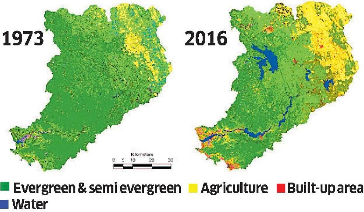
Infrastructure works affect not just forest patches but even water bodies. A study by the Indian Institute of Science (IISc) on Kali Tiger Reserve and Kali river is a clear indication.
‘Eco-Hydrological Footprint of a River Basin in Western Ghats’ — a study which assessed the eco-hydrological footprint at Kali River of Central Western Ghats — has revealed that there has been a decline in evergreen forest cover from 61.8% in 1973 to 37.5% in 2016. During the same time, the dry deciduous forest reduced from 7.82% to 2.24% in the catchment areas.
According to the report, there has been a reduction in overall forest cover from 84.69% to 54.94% in a span of about 40 years. The land use assessment was carried out by classifying the temporal remote sensing data into 10 categories. The report also revealed that the construction of a series of dams on the Kali River from 1980 to 2000 has resulted in large-scale land use. It has documented an increase in monoculture plantations of social forestry (Acacia sp) and horticulture (Areca) from 1.66% to 16.8%.
“Large-scale conversion of forests to monoculture plantation near the eastern plains is due to the industrial demand by Dandeli paper mill and other purposes. Agriculture has increased in the plains of Haliyal, Kalgatgi, Yellapur and Dharwad taluks, from 9.20% to 17.71%,” said T V Ramachandra, from Energy and Wetlands Research Group, Centre for Ecological Sciences, IISc. He is one of the authors of the report, along with S Vinay, S Bharath and A Shashishankar.
The increase in water bodies from 0.41% to 3.65% is due to construction of major reservoirs during this period, stretching their expanses in the forested landscape. Built-up areas have increased from 0.39% to 1.69%. A major increase can be observed at Yellapur, Dandeli, Kalgatgi, Kaiga, Karwar, Ankola, Haliyal, Ramanagar, Londa, Khanapura and Joida, he explained.
The report also highlighted inter annual water budgeting across sub basins which showed the Ghats and coastal areas are sustainable with perennial waters in the river as against the plains in the east which showed a deficit of resources, indicating water stress.