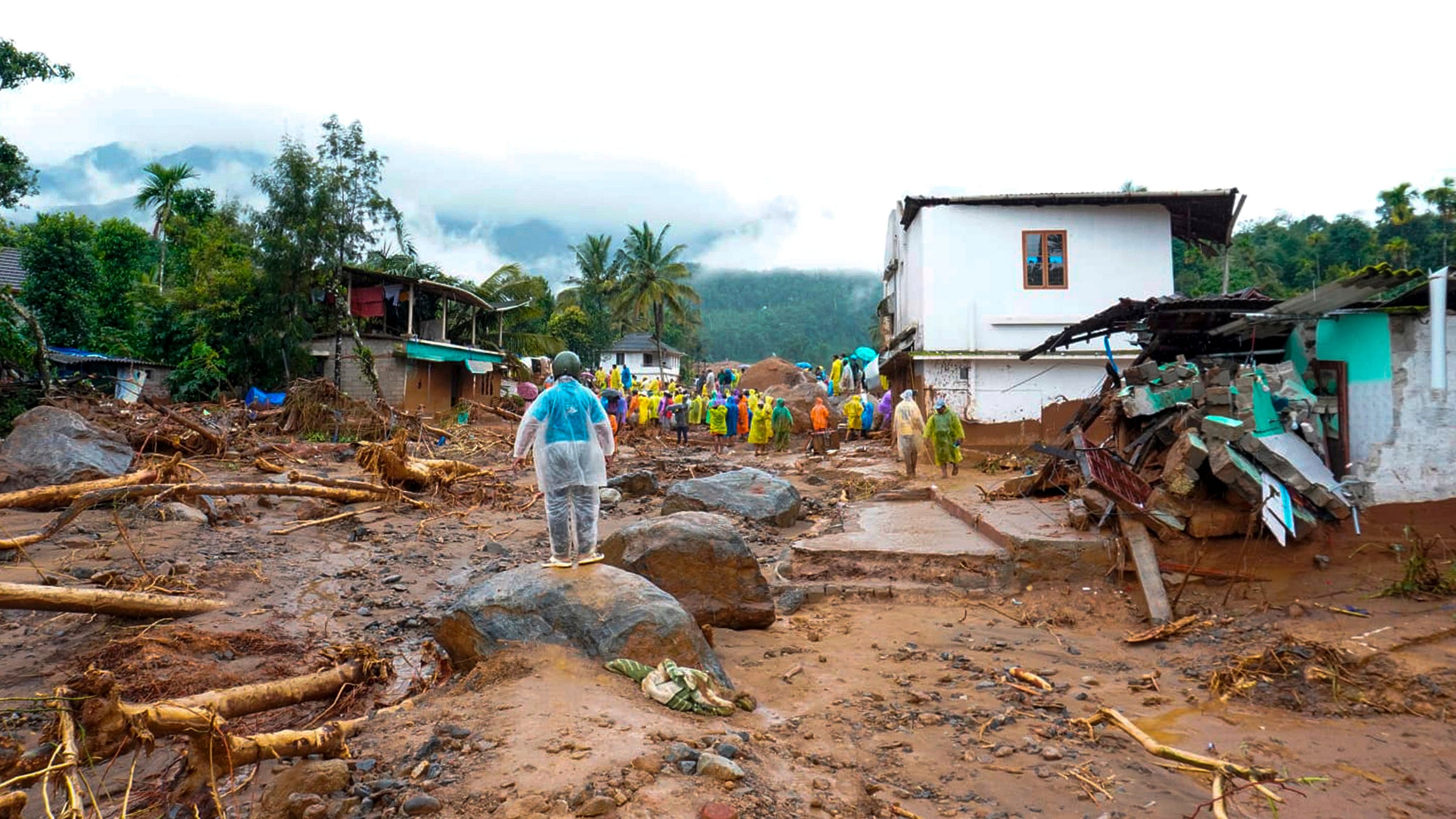
Rescue work following landslides triggered by heavy rain at Chooralmala, in Wayanad district, Kerala, Tuesday, July 30, 2024.
Credit: PTI Photo
Bengaluru: The landslides that devastated Mundakkai, Chooralmala, Attamala, and surrounding villages in Kerala’s Wayanad district and killed over 100 people on Tuesday hit Meppadi five years after another landslide in the panchayat, in Puthumala, that killed 17.
Climate experts and atmospheric scientists said extremely heavy rainfall was the primary cause of the disaster, with the region’s topographic features intensifying its impact.
The Mundakkai region, the location of the landslide’s origin, is a disaster-prone area with minimal human presence. The inundated Iruvazhinji River carried the debris, including large rocks and chunks of earth, on a steep downstream flow, washing away areas with human settlements, including Chooralmala, located about 6 km away.
It flowed further down into the Chaliyar river in the neighbouring Malappuram district, where many bodies were recovered.
The region received 57.2 cm of rainfall over the past 48 hours.
On August 8, 2019, landslides set off by torrential rain wiped out a village in Puthumala in Meppadi. The disaster-hit areas of Chooralmala and Puthumala fall within a radius of about 3.5 km. In Kavalappara in Nilambur, in Malappuram, another landslide caused the deaths of more than 40 people on the same day.
“Over the past five days, the region has received about 90 cm rainfall; areas in and around Chooralmala have recorded 37.2 cm rainfall over the last 24 hours. These are extremely high figures,” M G Manoj, a scientist at the Advanced Centre for Atmospheric Radar Research, Cochin University of Science and Technology, told DH.
He said the region’s sloped terrain aggravated the situation because the concentrated flow of the raging water made soil incapable of withstanding the impact.
“In Chooralmala, the disaster came from upstream areas. The debris wiped out entire stretches of the village,” Seenath S, a resident and former Chooralmala ward member, told DH.
The Nilambur-Meppadi region was one of the 18 Ecologically Sensitive Localities proposed by the Prof Madhav Gadgil-led Western Ghats Ecology Expert Panel (WGEEP) in its 2011 report. The WGEEP report proposed the extent of locations marked as Protected Areas and Ecologically Sensitive Zones 1 and 2 in the Western Ghats to be around 75 per cent.
The report was subsequently rejected, and another panel, under former Isro chief K Kasturirangan, brought the extent down to 37 per cent. The final notification of the Ecologically Sensitive Areas in Western Ghats, as identified by the panel, is awaited.