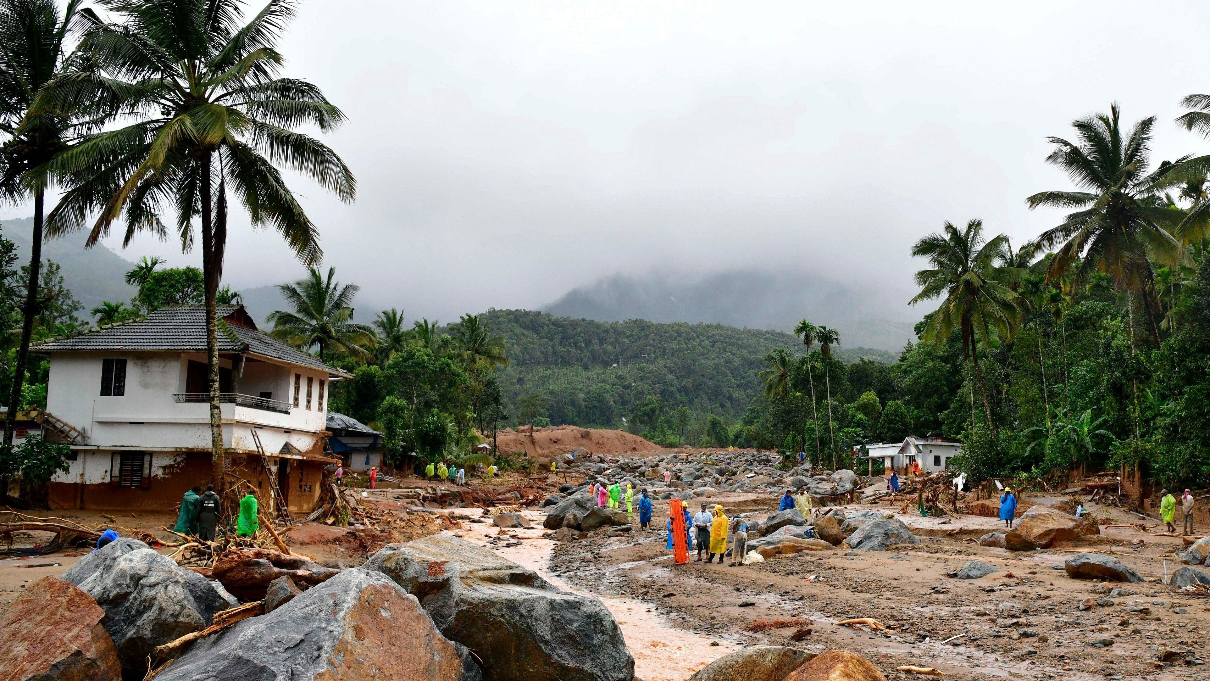
Rescue operations following landslides in Mylambadi, Wayanad district, Kerala.
Credit: PTI Photo
New Delhi: Destabilisation of the hill slopes may be the root cause behind the killer landslides in Wayanad with high intensity rain acting as the trigger, geologists said on Tuesday, urging the authorities to immediately demarcate the “landslide prone” areas in the Western Ghats and strictly monitor them to prevent future mishaps.
Over the years, the hill slopes are getting weakened due to human activities like farming and construction of roads and buildings, even though past studies have shown that Wayanad is prone to deep-seated landslides.
“The hill slopes are getting destabilised in many parts of Kerala and neighbouring states. It's time for the government to come out with zonation maps and identify the landslide prone zones,” senior geologist C P Rajendran, a former professor at the Indian Institute of Science, Bengaluru told DH.
Experts said that the high-intensity rainfall was only a trigger, but unfortunately it happened in the vulnerable slope region where the anthropogenic load was high.
The stability of a slope can be determined from land use and land cover besides analysing the nature of the structure, its gradient and curvature. “Depending on the instability of the slope, we can determine what could be the rainfall ceiling,” said geologist Kalachand Soin, director of Wadia Institute of Himalayan Geology, Dehradun.
Weathermen at the India Meteorological Department said strong south-westerly & westerly wind (up to 45 km per hour) along and off Kerala coast in lower atmosphere led to convergence of moist winds, which hit the Western Ghats, moved upslope and cooled to form clouds and rainfall. Many areas received 200-300 mm of rainfall within a few hours.
The soil was saturated after two weeks of rainfall and another bout of an intense precipitation led to percolation of water underground, weakening the soil. “The instability was triggered by the rain, but anthropogenic load may have played a role,” said Soin.
Heavy rainfall, flood and landslides (first recorded in 1882) are not new to Kerala, but such accidents are seen more often nowadays, thanks to a changing weather pattern coupled with unscientific urbanisation.
Kerala is also one of the most densely populated Indian states (860 persons per square km) which makes it even more vulnerable to damages and losses on account of disasters.
Rajendran, a former director of the Centre for Earth Science Studies, Thiruvananthapuram said geotechnical ways of stabilising the slopes would not be a universal solution as each vulnerable zone was to be studied to find out the remedy. “A landslide zonation map needs to be created along with continuous monitoring to prevent such calamities,” he said.
