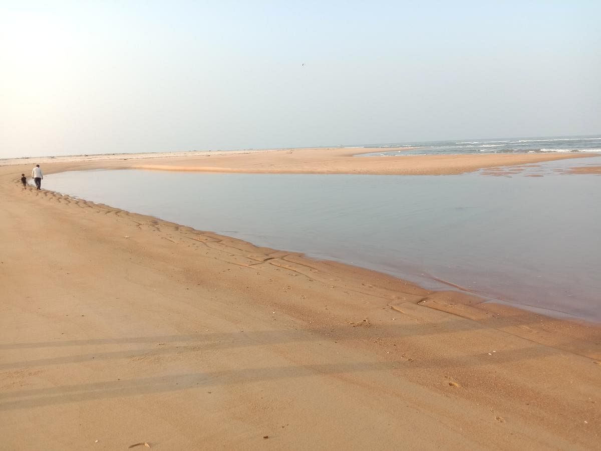
River Sharavati — who feeds the the world-famous Jog Falls in Uttara Kannada district and powers key hydel plants in Karnataka — is now at the centre of a fairly uncommon phenomenon.
She displays a straying common to rivers before joining the sea, but at an unprecedented and worrisome rapidity.
The emptying waters travel northwards, parallel to the coastline, for a distance of nearly 4 km before entering the Arabian Sea.
Oceanologists, however, say that due to Earth’s rotation, it’s quite natural for a river in the northern hemisphere to travel a little northwards before the final destination. However, this natural event occurs over decades or centuries elsewhere.
But the pattern here could be noticed in a year or two. And as a result, there is a formation of a considerable land area at the southern mouth of the river at the cost of erosion at the northern part of the river.
This is called spit growth, responsible for the shifting of river mouths.
“It’s amazing to observe the shift of the river mouth and the eruption of new land-mass between the coast and the river occurring this quickly,” says Dr Basavaraj G, a nature enthusiast and a witness of 10 years.
How it happens
According to the observations of V S Hegde, professor at the SDM College of Engineering and Technology, Dharwad, spit growth is observed across many rivers of the central west-coast of India.
Northerly spit-growth across some rivers of the region suggests a complicated sediment movement pattern along the coast.
“Erosion of the beaches and excessive deposition at the river mouth also leads to spit growth,” he observes.
The spit-growth patterns suggest that the spit across the river is growing rapidly — about 4 km in 30 years — and the river mouth is shifting northward.
At the same time, the spit on the northern side is eroding and the river mouth is narrowing.
To prevent the shifting of river mouths, seawalls have been constructed. But, they are collapsing, indicating spit growth is continuous and active.
Human interference like construction of dams and bridges leads to the variation in the water flow and changes the normal sedimentation process. As the spits narrow, the river mouth shifts and results in the erosion of the bank on the opposite side. To avoid this, groin construction on the spits is suggested by scientists.
Toll on estuarine diversity
As river mouths shrink in size, estuarine parts silt up. A large quantity of water during high tide does not move landward, and aquaculture including unique edible bivalve is affected.
During a tsunami, it is observed that rivers with wide mouths have simply accommodated the tsunami waves, whereas where there is a narrow mouth, the
reaction of the beach/spits with tsunami waves has resulted in erosion.
If the spit growth continues, the mouth of the rivers like Gangavali in Uttara Kannada district may close, and during the floods or tsunami, such rivers may completely shift their mouths, leading to a drastic change in the river-mouth morphology. To restrict the river into its channel, a long wall on either side of the river in the coastal area is suggested, especially for the rivers that are active in the migration phase. Also, if sediment flux is checked, spit growth can be minimised.
Old land, new land
Due to the northern shift of River Sharavati’s mouth, more than one hundred acres of land have newly appeared at the southern part. These are an extension of Pavinakurva, Mallukurva and Kasarkod villages in Honnavar taluk.
The revenue department has allotted fresh survey numbers to this newly created land. But villagers maintain that this land is very much owned by them with survey numbers in their name from the time of the British invasion.
Due to the rapid shift in the river mouth, the land which was present at the northern part of the river mouth is now seen on the southern side.
“This land is not new,” says Ramu Naik, a resident of Pavinakurva.
Rajesh Tandel says that the people of the erstwhile Mallukurva village, which got eroded, have migrated to the southern side of the river at Tonka village around three decades ago and no land was allotted in their name in return.
“Old topographic sheets suggest that said land belongs to the people of these villages,” says Dr Prakash Mesta, an oceanologist at Honnavar.
“As the right (north) bank of Sharavati started eroding, the fishermen and residents of villages Pavinakurva, Mallukurva, Kesarakodi lost their land gradually. They got no compensation. Now that — after two decades — the same land has re-appeared at the left (south) bank of the river, the revenue department needs to re-allot it to the rightful heirs,” he adds.
“Currently, a major chunk of this ‘new’ land is being leased out to a private firm to develop a private commercial port and construction works have started already. Meanwhile, the actual owners of the land seem to have lost their voice of protest to reclaim their property.”
Revenue officials maintain that any land having no survey number or the river-flow land belongs to the department, and it’s normal to assign new survey number.
“The phenomenon of shifting river mouths is not new. But in case of Sharavati, after the construction of reservoirs (dams), road and railway bridges across, she kept travelling parallel to the seashore northwards before joining the sea. This leaves a ‘new’ land in between, the land from the northern (right) part of the river mouth. And it’s only growing,” says environmentalist Balachandra Sayiimane.
Scientist M D Subash Chandran says the establishment of a series of upriver hydel projects has resulted in lowered salinity at the estuary.
As another effect, only 30 varieties of fishes survive there against 80 varieties that inhabit the adjacent Aghanashini river. Similar is the case with bivalves also.
This indeed needs attention, and right now.