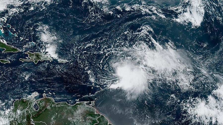
Tropical Storm Philippe to Bring Heavy Rain to Antigua and Barbuda.
Credit: New York Times
Tropical storm watches were issued for Antigua and Barbuda on Sunday, as Tropical Storm Philippe could bring up to 6 inches of rain to the island country through Tuesday, the National Hurricane Center said.
The hurricane center estimated that Philippe had maximum sustained winds of 50 mph, with higher gusts. The storm was about 195 miles east-southeast of Barbuda, the hurricane center said in its 8 p.m. advisory.
The center of Philippe is forecast to pass near, or just northeast of, the northern Leeward Islands on Monday and Monday night, producing up to 4 inches of rain in some parts, the center said.
“Notably, a very strong rain band on the southern side of Philippe will be very close to moving over the northern Leeward Islands, and it could turn out that rainfall and flooding would be the main hazard of the storm,” forecasters said.
The Atlantic hurricane season runs June 1 through Nov. 30.
In late May, the National Oceanic and Atmospheric Administration predicted there would be 12 to 17 named storms this year, a “near-normal” amount. On Aug. 10, NOAA officials revised their estimate upward, to 14 to 21 named storms.
There were 14 named storms last year, after two extremely busy Atlantic hurricane seasons in which forecasters ran out of names and had to resort to backup lists. (A record 30 named storms took place in 2020.)
This year features an El Nino pattern, which started in June. The intermittent climate phenomenon can have wide-ranging effects on weather around the world, and it typically impedes the number of Atlantic hurricanes.
In the Atlantic, El Nino increases the amount of wind shear, or the change in wind speed and direction from the ocean or land surface into the atmosphere. Hurricanes need a calm environment to form, and the instability caused by increased wind shear makes those conditions less likely.
At the same time, this year’s higher sea surface temperatures pose a number of threats, including the ability to supercharge storms. That unusual confluence of factors has made it more difficult to predict storms.
There is consensus among scientists that hurricanes are becoming more powerful because of climate change. Although there might not be more named storms overall, the likelihood of major hurricanes is increasing.
Climate change is also affecting the amount of rain that storms can produce.
In a warming world, the air can hold more moisture, which means a named storm can hold and produce more rainfall, as Hurricane Harvey did in Texas in 2017, when some areas received more than 40 inches of rain in less than 48 hours.
Researchers have also found that over the past few decades storms have slowed down, sitting over areas for longer.
When a storm slows down over water, it can absorb more moisture. When the storm slows over land, it can release more rain over a single location. In 2019, for example, Hurricane Dorian slowed to a crawl over the northwestern Bahamas, resulting in a total rainfall of 22.84 inches in Hope Town during the storm.